My Collectibles
This post is divided in three sections:
The Oak Lawn Collection,
my Blog on Lake View,
my second home,
and my collection of history, geography, and civic school books,
and finally my collection of globes from various years
The Oak Lawn Collection:
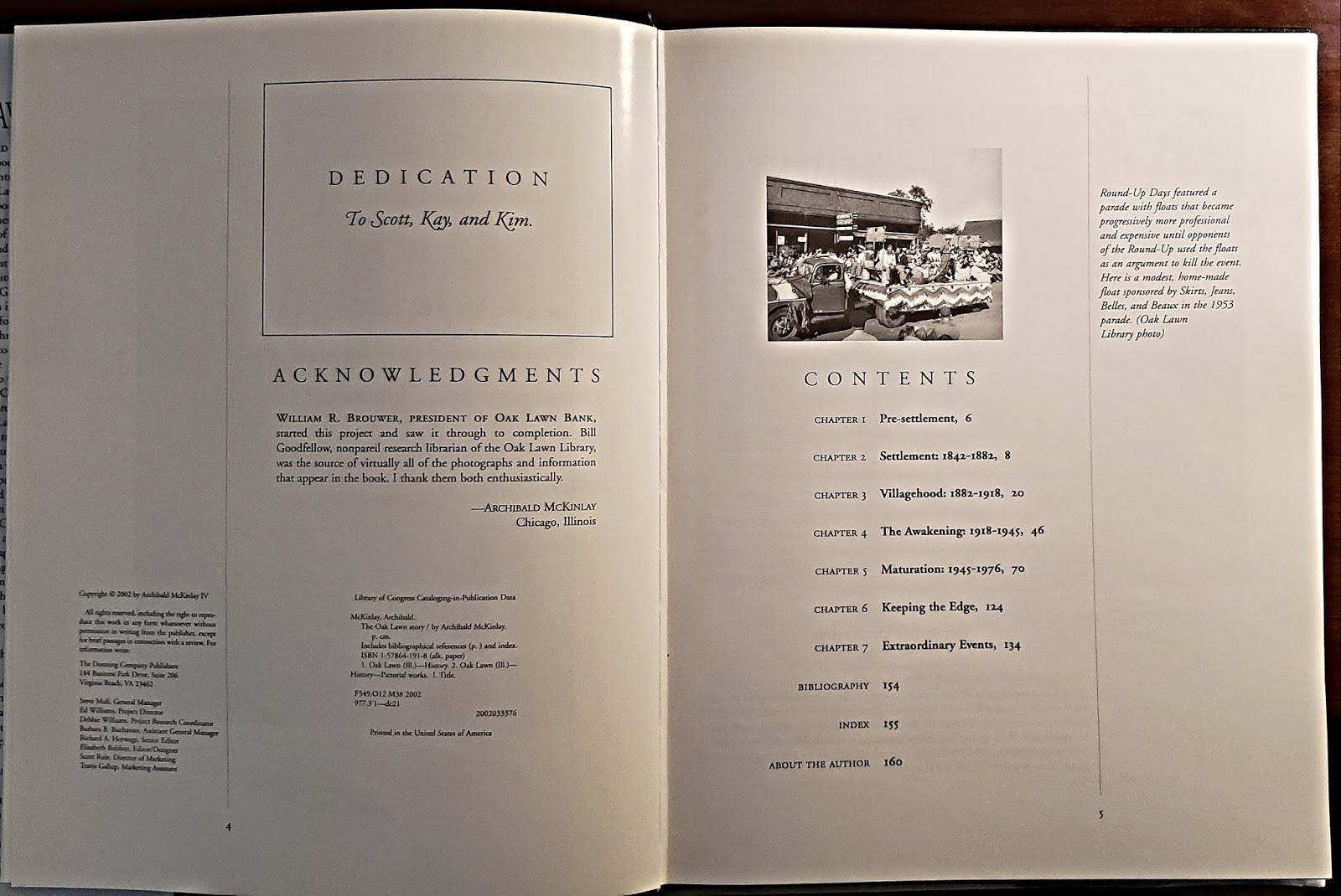
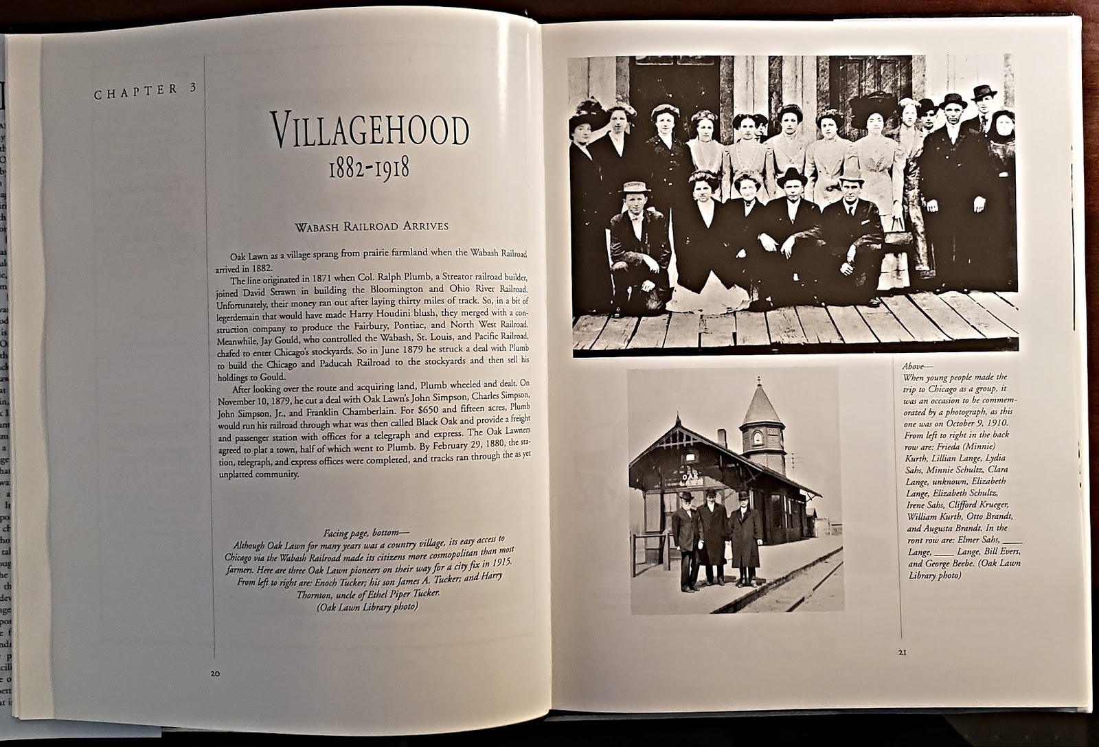
The Oak Lawn Story
by Archibald McKinlay
This book contains 160 pages about the history of Oak Lawn until year 2002. Its a wealth of information and photos from the
Oak Lawn Public Library and other numerous sources.
I will only post the chapter pages of this book.


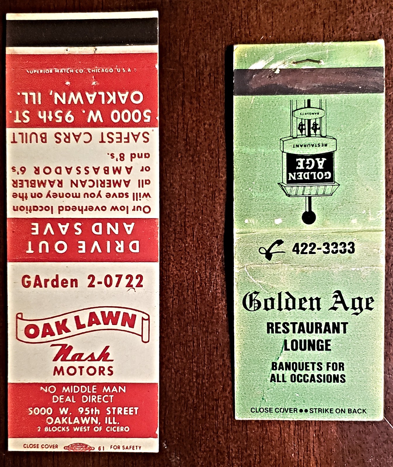
My OL Matchbook Collection
In 2020 I began a collection of matchbooks
of Oak Lawn establishments that I purchased from Ebay

reversed


reversed


reversed


No Inside Text to the Following

reversed


reversed

reversed


reversed


on its side


The Oak Lawn Public Library have their own collection of collectibles and you can access it with this link. Contributing to their collection would be awesome & tax deductible contribution to our memorable and rich history.
My Other Collections:The following sections of this post contains my blog of the history of my other home of Lake View, Chicago and my interest in books about geography, history, and civics/a lost & forgotten art
Lake View Historical Blog
The link above is the connection to my 70 + topical blog about the history of my other home - Lake View, Chicago where I spent
22 wonderful years as a resident to the point I found myself engulfed in its rich culture & long history and needed to blog it.
Pictorial Samples from my Blog


a view of Hawthorne Place Historical District

a view of Halsted Street in Boystown
Chris Cullen Photography


once the largest entertainment spots in Chicago


a vintage postcard view
his postcard is part of my private collection

once the home proud estates
This color slide is part of my private collection


Raymond Kunst Photography


Wrigley Field
Raymond Kunst Photography

Zachary Taylor Davis-Chicago Architect/Facebook

once known as the Howard & Ravenswood Lines


My Collection of Vintage Books:
History, Geography, & Civic
These three school subjects were my favorite at St. Linus Elementary School in Oak Lawn. Currently, all three are taught under the title of Social Studies. I wish they were not. Each subject deserves greater attention particularly in the subject of Civics. Civics is a understanding in how governments function & our place in it. I contend that to understand Social Studies students need the ability to have the knowledge & understanding of different folks from around the world & an unique understand their culture and how they evolved as a people. Each book has a different perspective on how each student should learn each subject.
I will only post selected pages from each book.
Vintage History Books:
The Story of Chicago


the authors story


In The Wilderness

(the work 'discarded' means removed from library inventory)


edited from previous image


In The Days Of The English


Part II
Our City


Riches And Health


Fires And Fire Fighting


Some Of Chicago's Busy Places


and according to the author ...


and a final note from the author

below is the back cover of the book

Chicago & The Great Conflagration


This 528 page hard cover history book is primarily about the Great Chicago Fire of 1871. This text-dense book was published one year later in 1872 with 28 irregular chapters. It reads like a fictional novel for a non-fictional event. The author claims first and second sources. The inside flap has a note to a friend dated 1884.
It's a good read!


Content Section
Chapters were listed in Roman Numerals
which was custom at the time of book's publication


to just south of Fullerton Avenue.
This book did not contain a lot of illustrations


the binding is torn away and will need to be repaired
and below the back cover of the book

The Book of Chicago

This 354 page hard cover history book was published in 1920. This text dense book has illustrations throughout
along with photographs of Chicago from late 1910's.


Each chapter page has an illustration or two

The Photography
While the illustrations were interesting there was not a caption for them so I only posted the photography that had captions


The Index


A School Book History of the United States
This is 326 page hard cover book was published in 1875This book was published ten years after the American Civil War


sample & random pages from this book


the back cover of the book

Vintage School Geography Books:
Introduction to Monteith's Manual
of Geography
(the print of the title has worn away)

This is a 61 page soft cover book published in 1960


The United States Census of 1860 was the eighth Census conducted in the United States starting June 1, 1860, and lasting five months. It determined the population of the United States to be 31,443,322, in 33 states and 10 organized territories. This was an increase of 35.4 percent over the 23,191,876 persons enumerated during the 1850 Census. The total population included 3,953,762 slaves. By the time the 1860 census returns were ready for tabulation, the nation was sinking into the American Civil War. - Wikipedia


West Virginia did not exist until 1863
during the American Civil War

This book highlights the Midwest as the West States

At this time most of the land west of the Mississippi were only territories except for California which was a State in 1850

Territories in 1860


map above - American Social History Project
The Rest of the World in 1860

Argentina and Bolivia had different borders while Columbia
was call New Granada that include Panama

Empires ruled in Europe while the British Isles ruled by
Queen Victoria was a constitutional democracy

Asia does not have any relationship to a current map of it
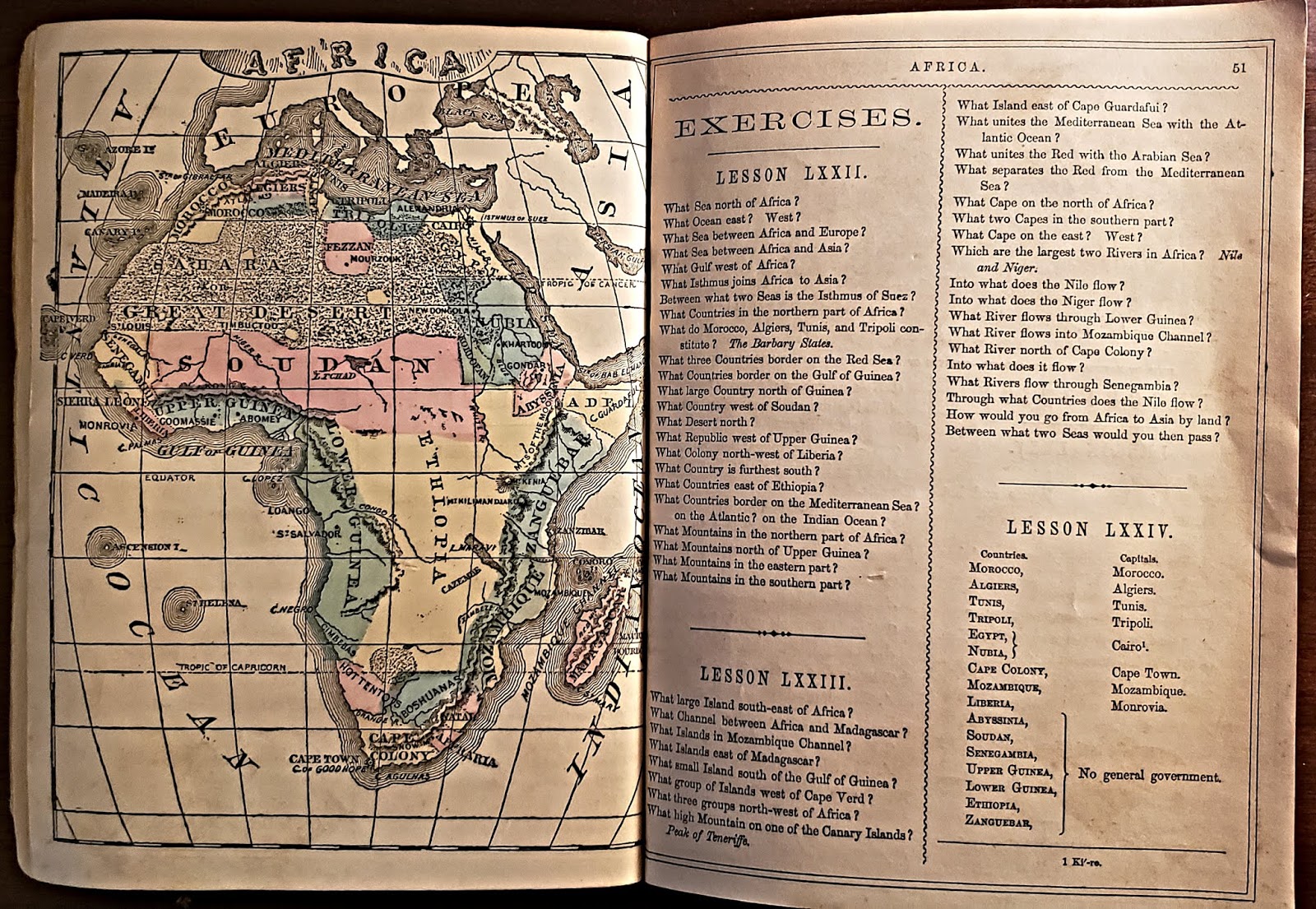
Africa was mostly unexplored by the Europeans at this time

According to this book Indonesia (blue) were not located in Asia

The books' glossary below

Gunot's Geographical Series [of]
Common School Geography
is 11 by 10 in size


zoom view from lower right of previous image


zoom view of previous image


The Classifications of People Lesson
from previous image


illustrations from previous image


The South America Section


illustrations from previous image


The African Section


an illustration from previous image


illustrations from previous image


The Europe Section


illustrations from previous page


illustrations from previous page


The United States Section:


illustrations from previous page


The United States in Regions


Central States
in the 1860 geography book this region was called the West


This is the first book that mentions this part of the country in any length and still there is not a map of it

*Juneau is the current capital of Alaska


text from previous image


Hemispheres


I. North America
(I like the use of Roman numerals as chapter headings)

II. South America


V. Africa

A Description of All Countries Section


many areas in the west were territories
except for California, Oregon, & Colorado


Illustrations of the Region from the previous image


School Questions on North America
Canada was governed by the British Empire

most countries were independent nations
and Bolivia was not land locked at this time

Empires ruled Europe


School Questions on Asia
The Qing Dynasty ruled in China


School Questions on Africa
The Europeans have not laid claim to the Continent
at this time and not until the late 1880's

Australia & New Zealand were governed by the British Empire


The Index Section


Natural Advanced Geography

This 200 page hard cover school book was published in 1901.
This book has special section on the State of Illinois.

Now, remember 1901 was in current time for students but to us in 2020 this presentation of the 1901 geography is now part of history


The publishers begin with an account of the United States most recent possessions. After the war with Spain in 1898 the US acquired Cuba, Puerto Rica, and Philippines with a promise with independence when political stability was established.


and it continues ...

illustrations from previous image


and continues to 'The Earth as a Whole' section


illustrations of landmasses


The following illustrations are under
the subtitles 'Life & 'Man'


Working on the Land & Water


Sectional Maps of the United States


map is from previous image
a density map below


The Northern Section


called Oklahoma


The Plateau States

Alaska & Hawaii would become a states 58 years later

Dominion of Canada


Mexico, Central America & Caribbean
Cuba & Puerto Rico is, at this time, a US procession


above is an insert of Isthmus of Panama before the construction of the canal and is part of the nation of Columbia in 1901


South America Section


The Europe Section
Europe like most of the world at this time were governed by emperors, kings, queens, a czar, & a kaiser

map from previous image


mostly of the German & Austria-Hungry empires


The Euro-Asia Section
In 1901 many areas of Asia were governed by the Europeans
and in the case of China under the Qing Dynasty

The Ottoman Empire


Siam is currently called Thailand

that was once composed of India-Pakistan-Bangladesh-Burma


The African Section

The Political Map of Africa
By 1901 most of the continent was ruled
by the prominent countries/empires of Europe - view legend.


In 1901 there was a war between the Boers/Dutch & Great Britain
Like all wars is was about money and who owned it.


The Australian & The Pacific Section

map from the previous image


The United States Possessions:
The Territories of the Pacific
Hawaii


the islands of Cuba & Puerto Rico (spelling)

A Special Section
The State of Illinois USA

one of several counties in Illinois


Springfield is current capital of Illinois - there were others

The Index


The Geography of Illinois
This is a 41 page soft cover booklet was published
in during the 1940's per the census table in the book


insert from above

The Corn Belt Region

The Grain Bay Region


from previous full page image
Cook County (Chicagoland area) had a population of over 4 million and a land mass of 933 square miles at this time per this chart

the back cover of the book

A Vintage Civic Book:
The Government of the United States
a civic book for students on how the government works


Table of Contents


random pages from the book


My Globe Collection:
I own three globes from various years in time. I only know that because as a student of history and geography I was able to pin point an historical event on the globe. I will explain ...
Manufactured between
1938-1944


 Manufactured between


This globe was manufactured between 1938-1944. I know this because of the country of Hungry (yellow) in Europe and its ownership of parts of Romania (blue) during this period in time.
The below image is the eastern hemisphere that highlights India (orange) as part of the British Empire and Indo-China (blue) as a possession of the Third Republic of France

1945-1949


Most of upper western Africa was still ruled by France


Most of upper western Africa was still ruled by France

Europe has new borders due to the aftermath
of World War II. The Iron Curtain becomes a term used to describe the political separation of the continent


The French recaptured Indo-China after the Japanese occupation during WWII. The flip-flop on names of Thailand was finally settled. During WWII Siam changed to Thailand (Japanese ally) and the in 1945 the changed back to Siam but in 1949 changed it back to WWII name of Thailand - a cartographer must had a headache for a couple of years.

Korea was one nation-state in 1945 after the war. That independence from Japan was short lived. By 1946 the Soviets occupied the north and the Americans the south. Japan was occupied by the United States after the war. China would became the People's Republic in 1949.

Manufactured
by 1963
Unlike the other globes this one highlights
the topography of the planet and presents some data


There was not any guessing on this globe. According to the data the population of 3.211 million occurred in 1963


lvhistorical@gmail.com


Comments
Post a Comment